My wife and I have always had the Utah parks on our “to do bucket list”, and this past spring we filled the bucket to the brim. We spent nine days driving through some of the most astounding scenery on the planet, in a 500-mile adventure starting in Moab and ending in Kolob Canyon. Along the way we passed through ten major attractions: Arches National Park (NP), Canyonlands NP, Goblin Valley State Park, Grand Staircase/Escalante National Monument, Capitol Reef NP, Kodachrome Basin State Park, Bryce Canyon NP, Best Friends Animal Sanctuary, Zion NP, and the Kolob Canyon section of Zion NP.
Whew!
Moab is in eastern Utah about 30 miles south of I-70. The town is rather touristy but has a magnificent setting in a curving canyon that leads to Arches National Park. In the Park over 2000 gorgeous arches have been created by 100 million years of water freezing and expanding in cracks in the Entrada and Navajo Sandstone, and wind blowing away the broken and fallen bits.
We loved the enchanting Amphitheater canyon and picnic ground at the north end of the 18 mile-long, dead-end road through the 119-square-mile park. The nearby Devil’s Garden Campground had one of the best locations we have ever seen, with great views off to the east. While driving in, many of the iconic arches can be seen from the paved road, and marked, dirt hiking trails lead to dozens more. The Fiery Furnace Viewpoint is excellent for viewing the Milky Way and the stars on a clear moonless night.
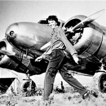
After a day and evening at Arches, we drove 30 miles southwest of Moab to the quite different Canyonlands National Park — fewer arches but 527 square miles of countless colorful canyons, mesas, fins, spires and buttes carved by the Colorado and Green Rivers. This massive part of the Colorado Plateau was unmapped until 1869, when explorer and naturalist John Wesley Powell, a one-armed Civil War veteran, led an expedition down the Green and Colorado Rivers from Wyoming to Arizona and through the Grand Canyon. When he started, he knew that chances were good that his team would die in the canyons. He wrote that, “We are now ready to start our way down the Great Unknown. We have an unknown distance to run, an unknown river to explore. What falls there are, we know not. What rocks beset the channel, we know not.”
Powell and five of his team did survive; three disappeared into the wilderness; and one “got tired of adventure,” left the expedition, and miraculously found a Paiute village where he lived for years.
There are four districts in the huge Canyonlands park, but only two are accessible by car and these two are separated by hours of driving outside the park. So we limited ourselves to the most accessible area, the Island in the Sky District at the north end of the park. The best bit of this District was the magnificent overlook of the Green River canyon, with snowy mountains in the far distance. Like many NPs in Utah, the Park is penetrated by a dead-end paved road, in this case 20 miles long, from which numerous hiking and biking trails fan out. (ATVs are not allowed in this and most NPs, but can be ridden in the surrounding public lands.)
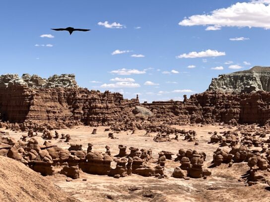
We departed the Moab area and headed southwest for isolated Torrey, Utah on I-70 and Utah route 24. Along the way we stopped at the bizarre Goblin Valley State Park. We heeded the warnings on the Internet that most GPSs mis-direct drivers to the park entrance by 15 miles too far to the south, and instead followed the marked highway signs. We emerged into a strange and exotic park unlike anything we had ever seen. Thousands of “goblins” – scientifically known as “hoodoos” – filled three flat valleys that extended for four miles to the south from the overlook picnic shelter.
The hoodoos varied from 2 to 20 feet tall, and looked like frozen stone figures. They were formed over 170 million years by “spheroidal weathering,” where siltstone and shale was dissolved by rain and blown away by wind, leaving rounded, harder sandstone to entertain modern visitors like us.
There are no hiking trails in the flat valleys; visitors can just wander at will. Just be careful not to climb on the goblins – they might bite!
Next month we will continue our journey southwest through the terrific parks of southern Utah.
Photos courtesy Lew Toulmin
-

- 1. Map of our route through southern Utah, showing the major parks and attractions visited.
-

- 2. The famous Delicate Arch at night in Arches National Park. The Park has been certified as an International Dark Sky Park.
-

- 3. A local crow seems unworried that a 100-million-year-old balanced rock in Arches National Park in Utah will fall on him.
-

- 4. Landscape Arch in Arches National Park is 306 feet wide, the longest stone arch in North America. The arch is a 1.8-mile roundtrip easy trail hike from the parking lot.
-

- 5. A spiral tree in the Amphitheater canyon picnic ground, at the north end of Arches National Park.
-

- 6. A view of the canyons carved by the Green River, a major tributary of the Colorado River in Canyonlands NP. The bright dirt trail curving around the canyon is used by mountain bikers to circle the entire area. The bike trip takes at least two days.
-

- 7. Explorer John Wesley Powell on his historic 1869 expedition down the Green and Colorado Rivers, and through the Grand Canyon – an amazing first descent.
-

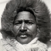
- 8. Plaque in Canyonlands commemorating the work of President Lyndon Johnson and Secretary of the Interior Stewart Udall (pictured), who in 1964 pushed through the Wilderness Act, created Canyonlands National Park, and saved millions of acres of wilderness for posterity.
-

- 9. A bird flies over some of the thousands of goblins/hoodoos at Goblin Valley State Park in southern Utah.
Slideshow:


Comments are closed.